| Page last updated:
28/05/2021 |
|
Views of or around the town captured
by a Kodak bellows camera of around
1928 - plus other contributing
cameras, earlier and later.
|
|
If you have 'old' Sawbridgeworth
pictures that you would like to
contribute please contact the
Webmaster. |
|
The Pictures on this page will
enlarge when clicked with your mouse |
|
|
Sawbridgeworth Listed Buildings |
(The
listing includes the base of the
crane in the pictures below) |
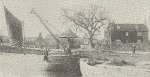 |
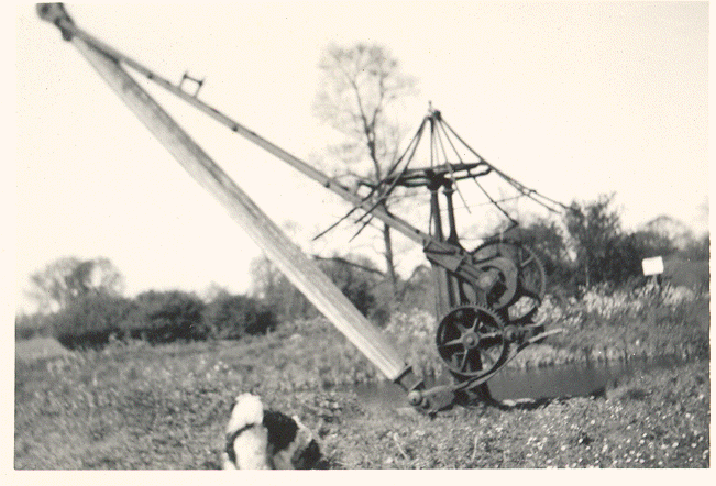
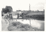
This
Wharf-side crane once stood on the green area almost opposite the
Orchard Maltings in Station Road. As can be seen, it was used to offload barges on the
River Stort but it is not known who for - perhaps the Maltings? A very early
picture of the crane in use and complete with, what looks like a canvas
'roof'. The 'main' maltings are in the background and Bridgefoot Farm to the
right. |
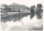 |
| Left -
The Wharf-side crane seen from across the river Stort, taken from the
slope on the towpath from the road bridge. This shows the Orchard
Maltings on the West side of Station Road. This malting was severely
damaged by fire in the early hours of December 10th 1921 but there
appear to be no 'photos of this. Most of the vehicles parked
are owned by enthusiastic fishermen, two of whom are on the bank. |
 |
|
|
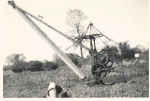 |
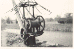
| Amazingly, the
crane stood for years in this almost fully workable condition, all of these
photographs being taken in around 1956. The pictures were taken on a
Sunday. |
 |
Left: Another view taken from the tow path on the East of the river, opposite
the Wharf. The Bridge takes the old A414 over the river. In the distance the
R5 malting has been substantially modified. It had been developed into a
second Malt Extract Factory for the British Diamalt Company, part of the
H. A. & D. Taylor group. |
|
 |
Left: Yet another view of the
maltings leading down towards R5. This time showing three Faggot
Stacks on the 'island' used expressly for that purpose. Faggots#
were cut in the Essex woods and were burnt in the malting kilns
to roast the barley grain. The type of Faggot used influenced
the flavour of the final malt product.
# Bundles of thin saplings about 12"(30cm) Diameter x 48"(120cm)
long.
(Picture kindly supplied by Joseph Fizgerald) |
 |
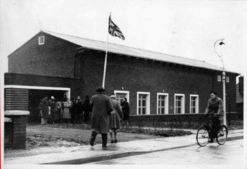
| Memorial Hall to the Fallen of
two World Wars. Started life at Sawbridgeworth aerodrome and was
rebuilt at The Forebury. This was the official opening day. |
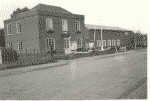 |
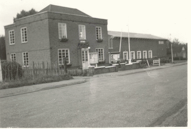
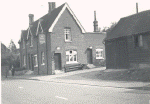
The Council
Offices (now the Public Library) and the Memorial Hall
(beyond),
within a few years of the latter being built. The Memorial Hall site was school
dugouts during the 1939-45 war. |
|
 |
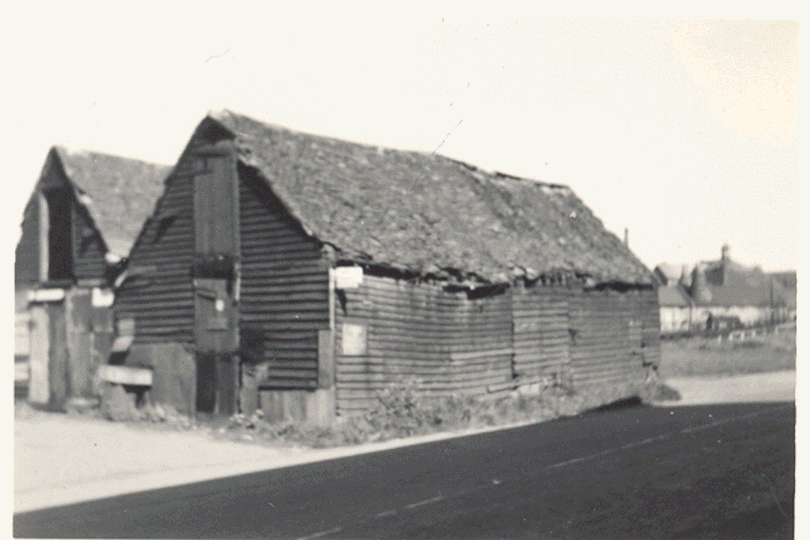
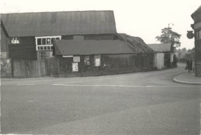
| These
two barns, believed demolished early 60's, once stood on the Station Road Wharf almost opposite the South
end (Nearest) of Orchard Maltings, about where the far end two or three
cars are parked in the picture above. The Shadow cast on the road is
presumably from the Maltings. By this time the Maltings no longer
belonged to H. A. & D. Taylor but had been purchased and substantially
changed internally by Chisholm Fox and Garner Ltd., a company manufacturing sacks. |
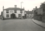 |
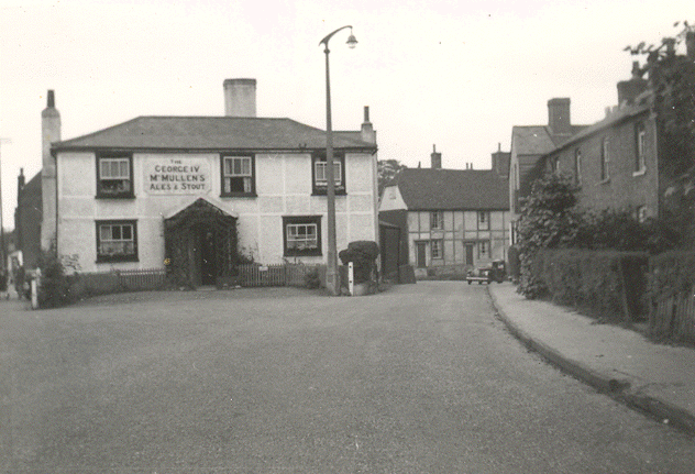
The George IV
Public House at the North end of Knight Street. The street lamp
dates the picture - this was still the pre-war design of which there
were about three only in the whole street. |
|
 |
|
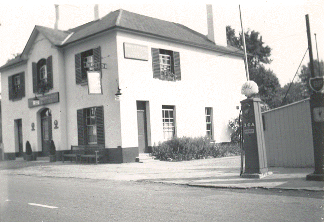
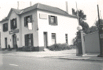
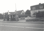
Left - The Railway Inn,
Station Road sold Shell and BP Petrol - the days before the two
companies separated. Station Road in those days was the A414 main road,
St. Albans to Chelmsford! |
 |
Another Public
House in Station Road, The Fox. Used heavily in the days of the barges
on the river, by bargemen who stayed overnight and stabled their horses in the
buildings on the right. |
|
 |
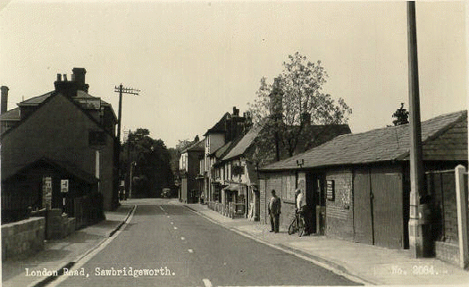
London
Road facing South - the road sign indicates the Bell Street junction,
then a two-way road. Once again the Streetlamp in the foreground
indicates that this was early 50's. There is a passage way immediately
to the right of the Lamp Post leading through to the Cinema in Sayesbury
Avenue/Road. The Man with the bicycle is Harry Read, a Fireman, and the other
the Webmaster's Paternal Grandfather. The building in front of which
they are standing was a sort of antiques emporium and just further down
the road is the Public House called "The Prussure [sic]" to which one
entered by descending about 3 steps from pavement level. |
 |
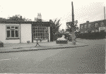
Walnut Tree Corner facing South - junction of Cambridge Road and
London Road, Station Road and West Road. This picture taken long before
the alterations to cater for the increase in traffic the road now
carries, probably early 50's. Close scrutiny of the left hand side shows
the corner sweet shop operated by a Mr. Beavan. On the opposite corner
stood Quinney's [sic] Antiques and next door a chemist shop, both owned
and operated by Mr. M. W. Bush. |
 |
| Walnut Tree Corner
- looking down Station Road. The facing buildings were Nelson J.
Lawrence Builders Yard. The sweet shop mentioned above is on the right.
'Jutting out' into Station Road is the Taylor's shop of Arthur Hill - it
became a butcher's when Arthur moved to the little shop on Knight Street
'behind' the George IV Public House. |
 |
Another view of
the corner, this time the Bus Shelter and West Side Stores. |
|
 |
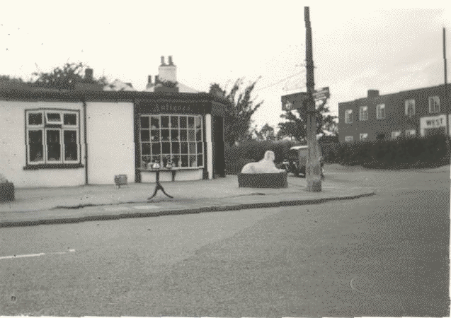
| Quinney's [sic]
Antiques in London Road. To the left was a chemist and next to that, E.
Emery & Son, Electrical Contractor's Shop. |
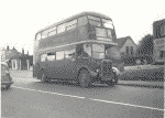 |
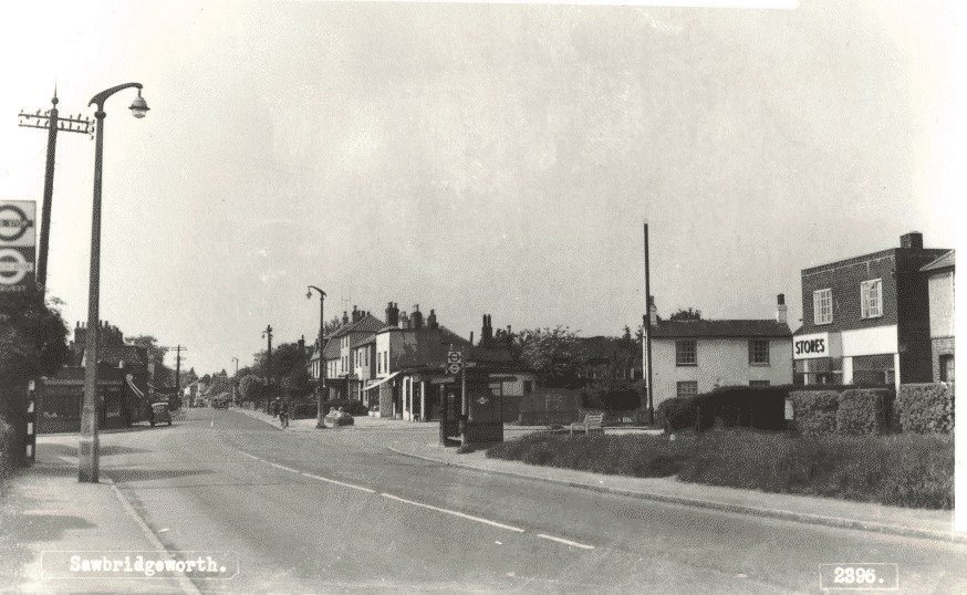
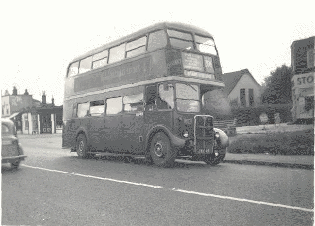
Epping to Bishop's Stortford. The 396 Bus Route was a frequent
service in the 50's, about every twenty minutes - half hour. This was indispersed with
the Green Line Coach Service that ran between Aldgate (London) and
Bishop's Stortford, every hour. Many times there was no room to get on,
the alternative being the Green Line - not so many stops but more
costly! |
|
 |
|
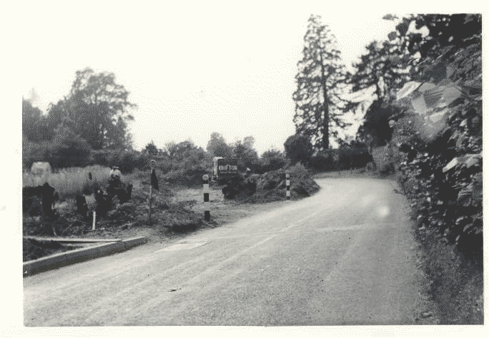
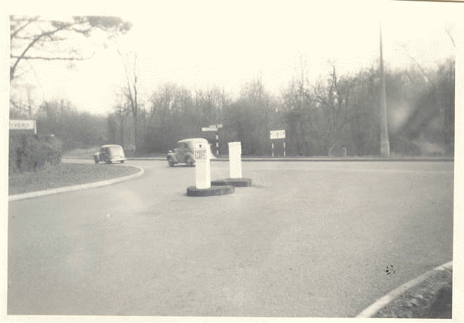
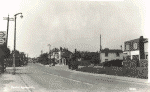
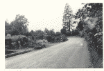
The A414 road looking West, (left), as already mentioned above, ran
right through the town. From the West it joined the A11 as a very narrow
and winding road, particularly past the entrance to Rivers Nursery just
by the tall Redwood tree in the photograph. The picture shows work
started on widening. |
 |
|
The photograph (left) was taken facing East, with cars on
the A11 going towards the town. The new wider road and improved
junction now complete. |
 |
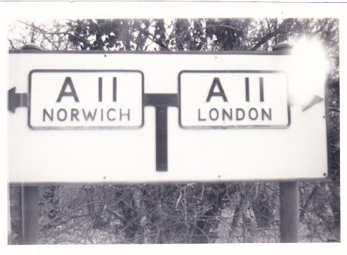
| |
The enlarged road sign on
the A11 as shown in the
photo left. |
|
|
|
|
|
V2
Rocket incident |
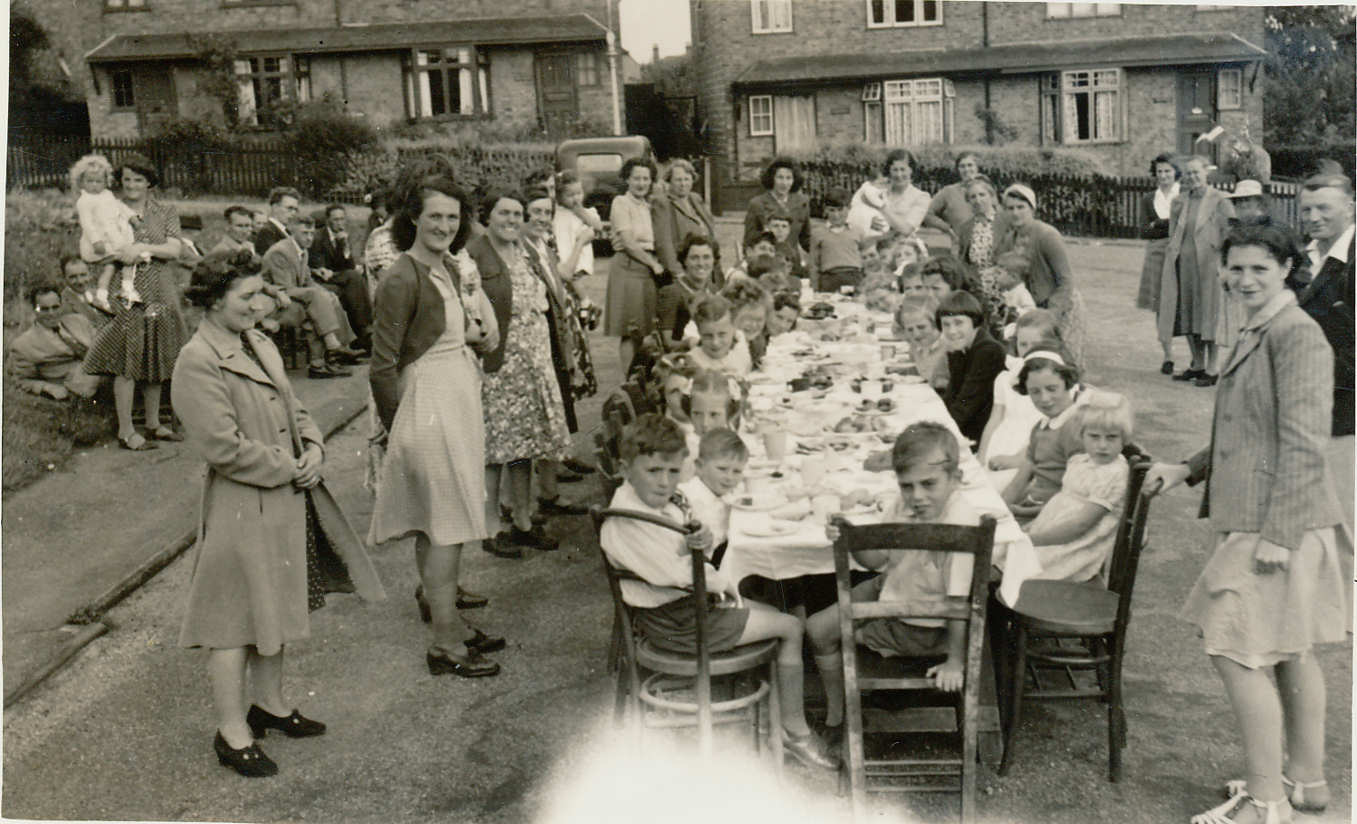
| This picture was taken towards the end of August 1945 and was
a children's party held in Springhall Road, for the children of that
road and
Vantorts Road, to celebrate the 'final' end to the 1939-1945 war -
Victory over Japan - V.J. Day. The Webmaster is in this picture aged 10 and many
other faces could be named. At the rear of the semi-detached house on the
right of this photo is where
a huge part of a V2
Rocket - the rocket 'engine'
- landed in the
back garden (August 1944*), the remnants of
one that thankfully exploded
before reaching ground
level! |
*More recent information
(2021) has determined that the date
of the explosion was in
January 1945 and was actaully between High Wych
and Sawbridgeworth in the
vacinity of what is now
Falcolners Park - see map
postions
HERE.
Source: Via
Newspaper
Article |
|
 |
|
|
|
 |
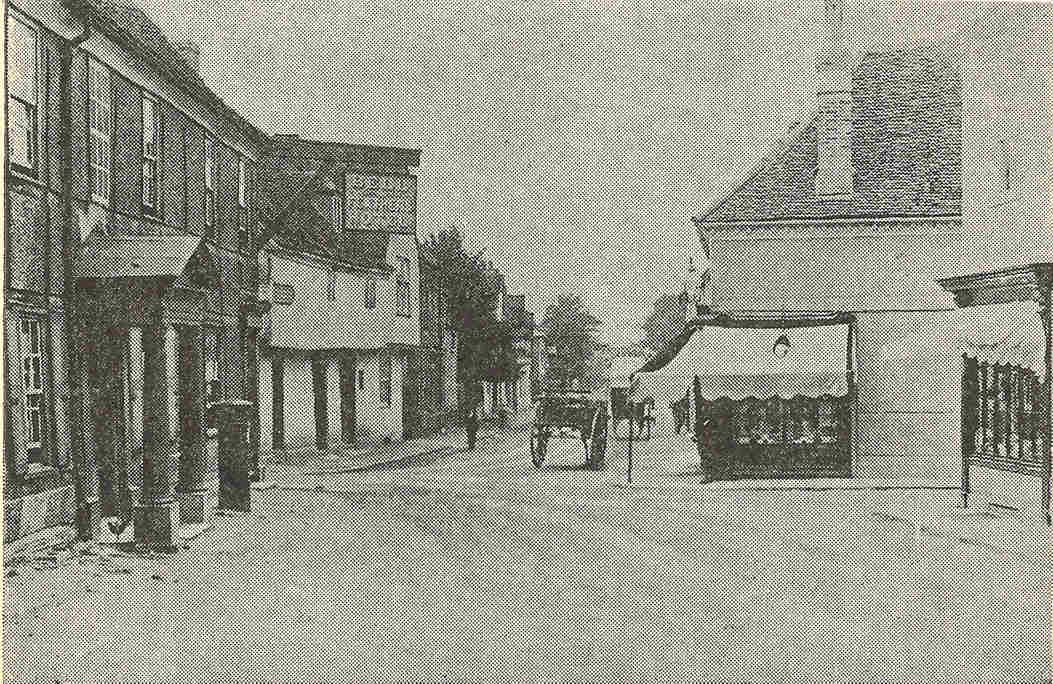
| The picture left and that below it, and below below
right,
are taken from a publication "The Story of Sawbridgeworth" which appears
to have been published around 1964. The Market House is on the left and
the cottages on the right were adapted to shops in the late 1950's. |
 |
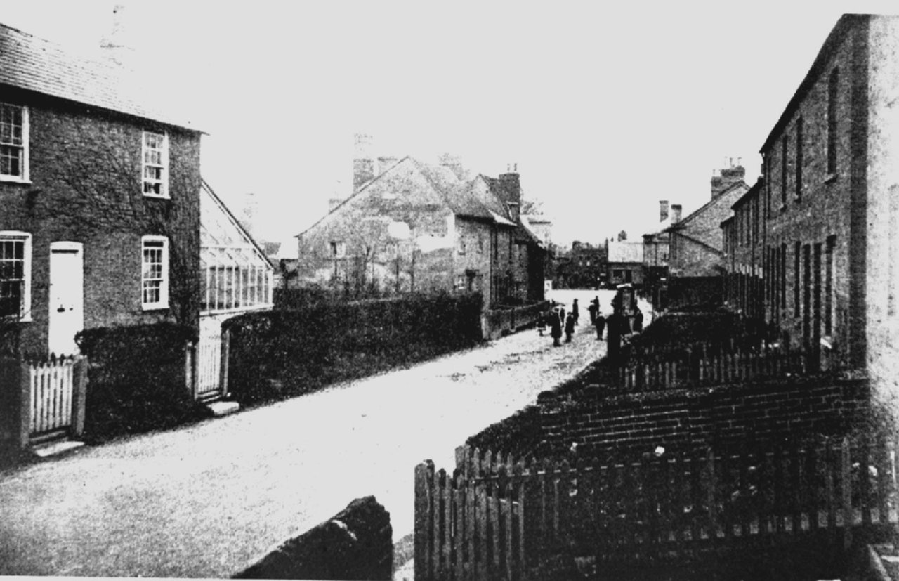
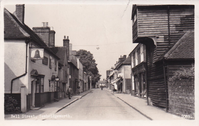
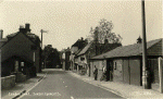
Left, Bell Street again but now in around 1950. The Cottages mentioned
against the picture left are still there and of course the road was
still two way traffic. The picture was probably taken on a Sunday
because of the lack of shoppers and traffic. The shops to the left were
a hair dresser's (Miss Joyce M. H. Neal) and The Star Supply Stores. The Bell Public
House is beyond the cottages. |
|
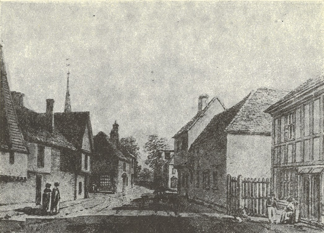
| Above - Bell Street 1834 |
 |
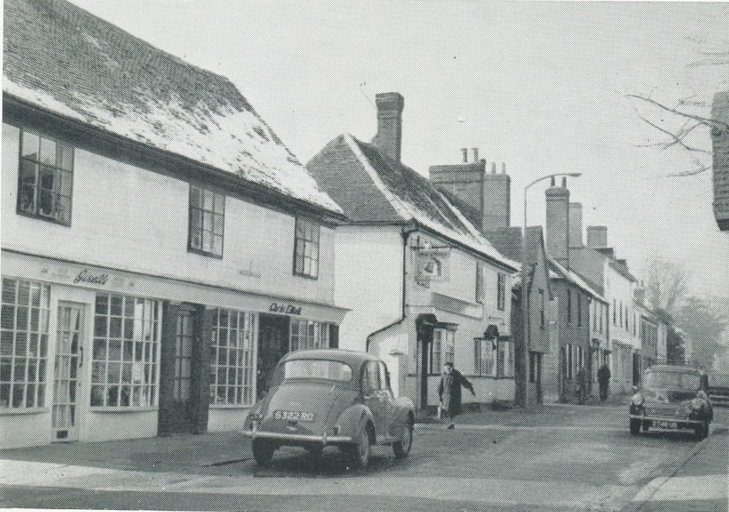
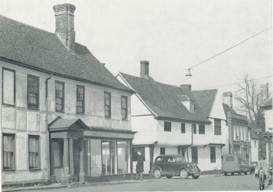
| The
picture left of Bell Street was probably either the end of the 1940's or
early 1950s! The malting on the left was now used only as a store but
the sack hoist would have still been operative at this time. |
 |
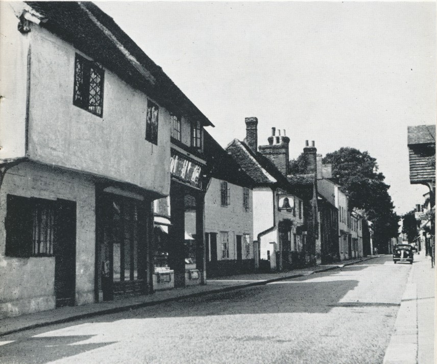
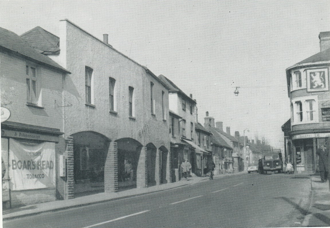
Another shot of Bell Street probably around 1965 where the Cottages
mentioned elsewhere have now been converted into shops. Run by Chris
Elliott, Chris Elliot's was a Television and Radio shop the proprietor
having previously been the TV engineer at White's Garage in London Road. |
|
 |
Left
- The Square in about 1900.
In
this picture the Market house is on the left opposite the horse drawn
cart and immediately on the right what became Forrest Stores and in the
early 1960's Fine Fare supermarket. The shop on the right of The Square
became Charles Riches Ironmongers. On the left of The Square is the Bell
& Feathers Hotel. After the 2nd world war it became a furniture shop
operated by Charles Riches.
Left - The Bell and Feathers -
Picture courtesy of Richard Dyer (*). |
 |
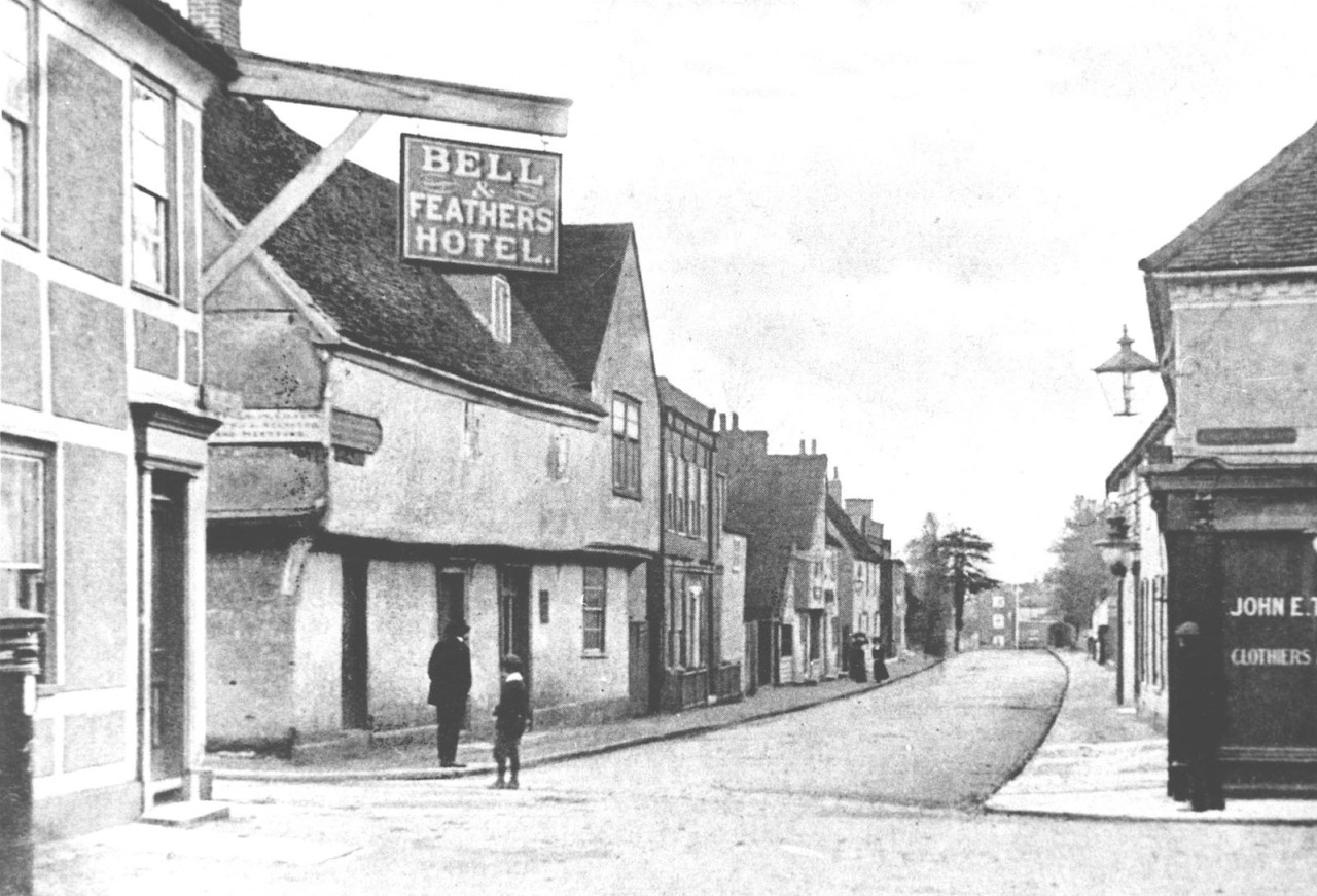
Left - Corner of Bell Street and London Road 1887 or 1897
celebrating Queen Victoria's Golden or Silver Jubilee. Surprisingly showing a telegraph pole on the right which
would seem unusual for that period! The Store on the left predates what
later became Gages Department Store in the 1930's and much modernised in
the late 1950's or early 1960's. The Public House on the corner was later replaced by a
new building - used largely by Harris's Bakery (See
the 1905 photo).
Picture courtesy of Richard Dyer. |
|
 |
|
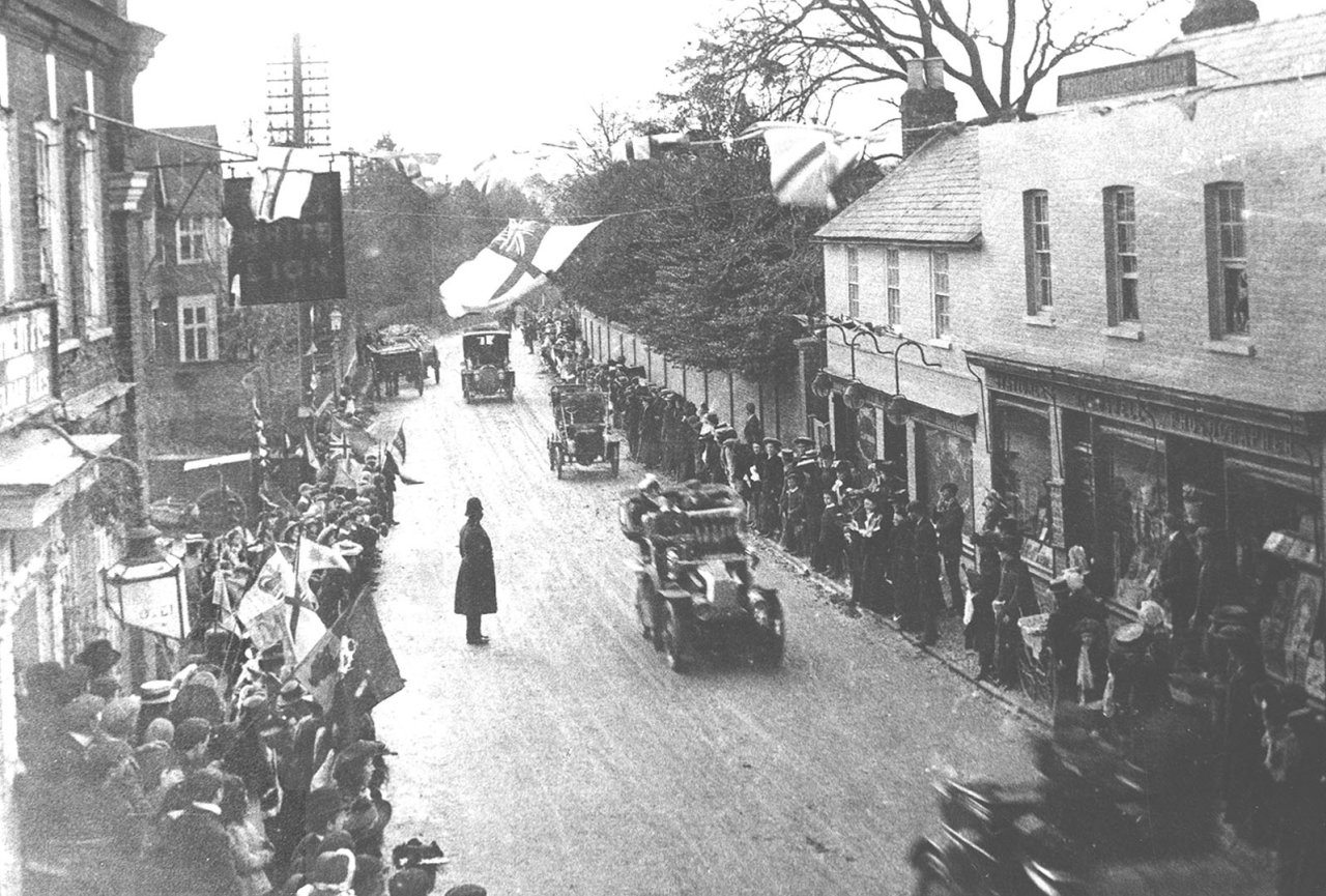
Right - Apparently King Edward VII travelling
through in 1903 - probably on the way to Newmarket Races. Picture courtesy of Richard Dyer.
|
 |
Right - The London Road Bell Street junction before the
changes to Gages, probably late 50's. This was the main A11 - London to
Cambridge road. What a difference in traffic to later years! |
 |
|
 |
 |
 |
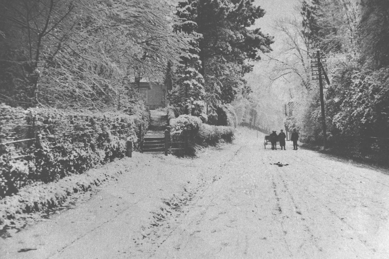
Left - Bonks Hill in winter c.1905 (The main road through
Sawbridgeworth!) Picture courtesy of Richard Dyer.
|
 |
|
Above: Knight Street c.1905 Picture courtesy of Richard Dyer.
|
(*) Richard Dyer's father ran a butcher's
shop (the photographer's side of the tree) in Knight Street prior to WW2. |
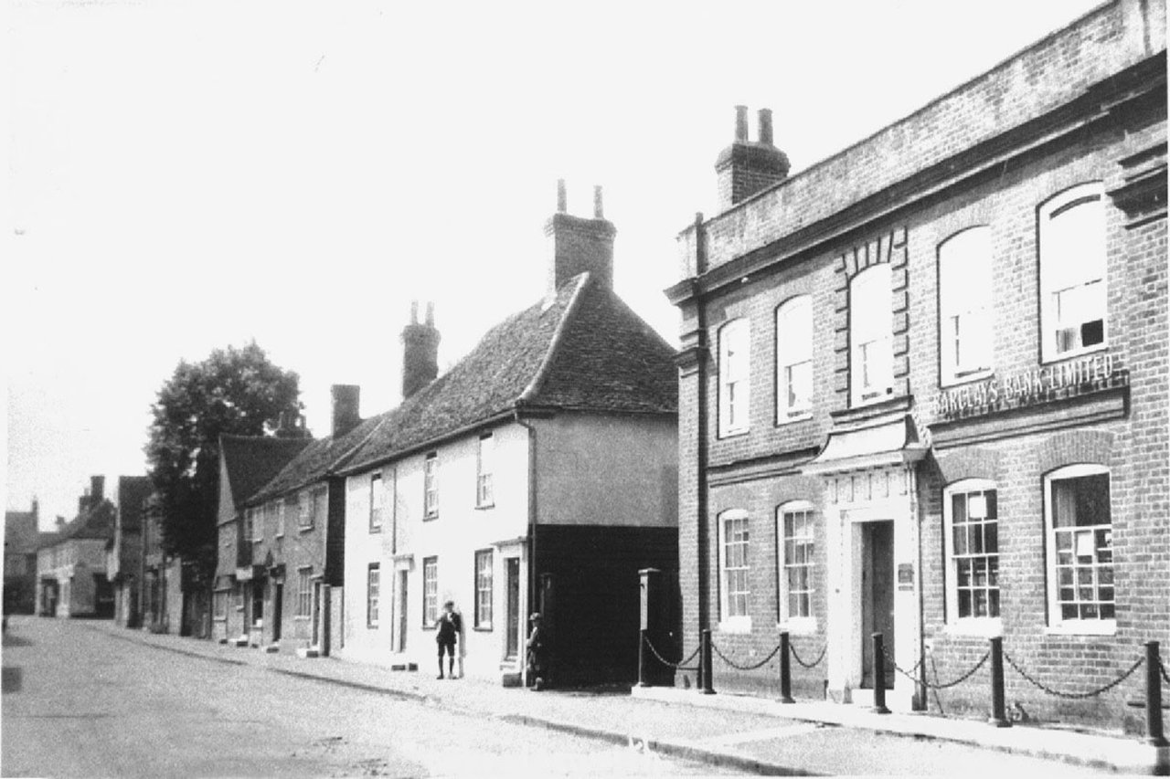
Above Left -
Knight Street ,Barclays Bank on the right with the Bell & Feathers in
the distance.
Picture courtesy of Richard Dyer. |
|
Station Road c.1910 - in the distance the George IV
public house.
Picture courtesy of Richard Dyer.
|
 |
| The Square again, probably in the late 1950's early
1960's. A better view of the Market House - the Feathers Hotel now in
use as a quite large furniture shop operated by Charles Riches Ltd who
had the Iron Mongers shop opposite and a china shop in Knight Street. |
 |
Here, around early - mid 1960's is the junction of
London Road and Bell Street again facing North towards Bishop's
Stortford with the new Gages Store on the left and Thorogoods
tobacconists and sweet shop far left. Harris bakers shop is on the
corner of Bell Street and the sign of the Lion Hotel can just be seen.
The sub Post Office run by Mr & Mrs. Richard (R.A. Dicky) Burton is behind the man standing on the
pavement. |
|
 |
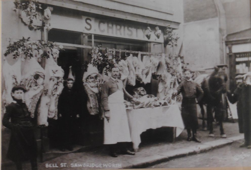
No 5 Bell Street
is at
the London Road end of
the street. The
Butcher's Christy (photo
early 1900s) later
became Christy & Blake
in the 1950's, one of
around three butchers
shops at that time. |
 |
Bell Street
almost certainly late
1940's or very early
1950's on a Sunday
morning. The gentleman
walking on the left is
the Webmaster's Paternal
Grandfather and the
cyclist in the distance
is thought to be Albert
Butcher who worked at
the time at Vantorts
Farm. |
|
|
Photo courtesy of Mrs Edna Richardson |
|
|

|
 |
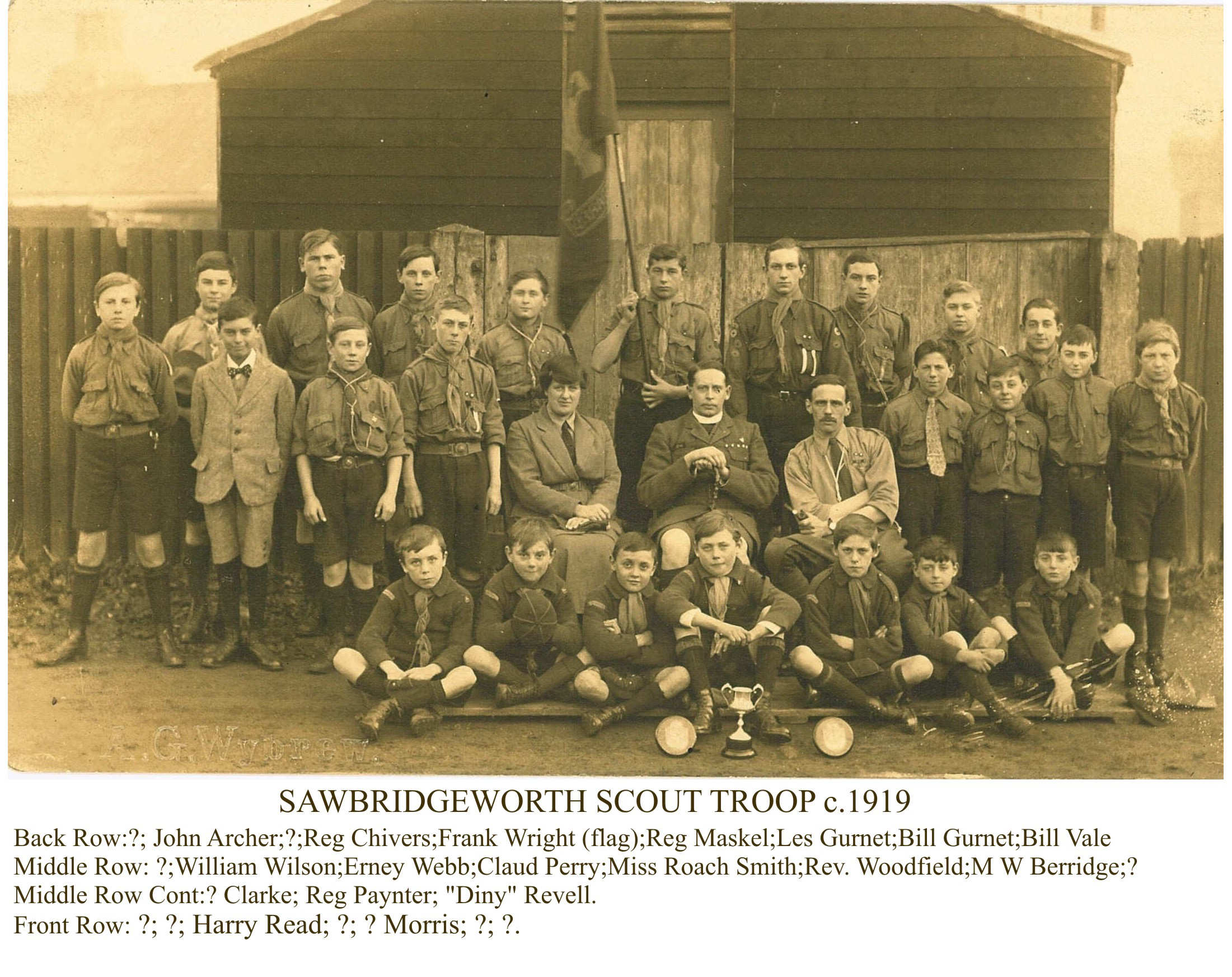
| Sawbridgeworth Scouts c.1919. The Scout Hut was in Station Road at this
time, moving to Springhall Road before the 2nd world war. After the war
the Scout Master, for many years was Captain Harris of Harris Bakers
whose premises are mentioned in the above right picture. |
 |
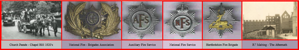
Another venue another day but the Scout membership seems to indicate
that the date is similar to the picture left. Many of the Scout members
became Firemen either a little later or later in life as part of the
National Fire Service in the 2nd World War. |
|
| |
|
| ◄----- |
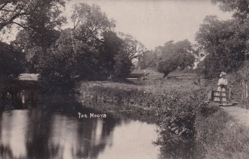
More views of the
River Stort in the late 1950's |
-----► |
Also see:
Miscellanea |
 |
 |
 |
 |
 |
|
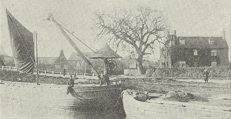
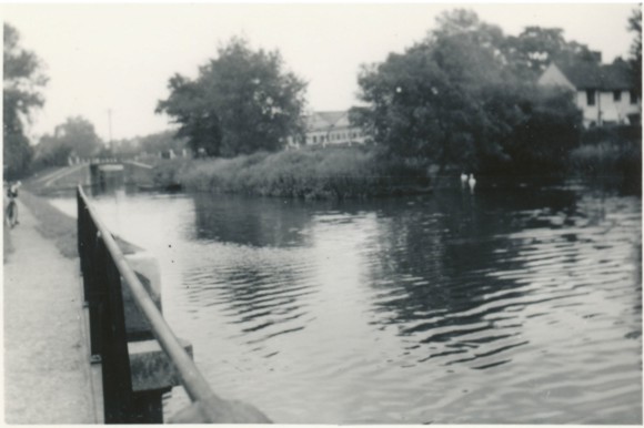
River at Sheering Mill looking North East towards the lock. Walter Lawrence
in the background. |
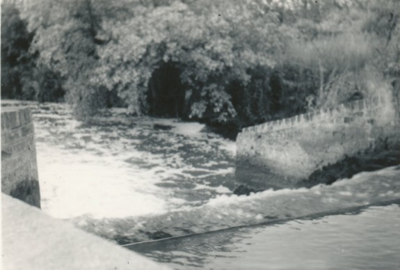
The Sluice opposite the maltings (R5) one of the popular
swimming places for locals. |
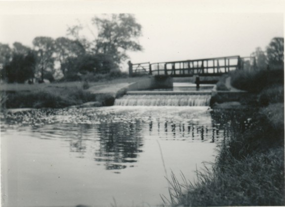
The waterfall at the Moors - another popular bathing/ swimming
venue. |
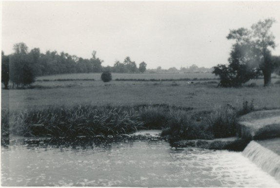
The Moors as left but looking back towards Sawbridgeworth |
The Mill (Sheering Mill
Date unknown)
Picture courtesy of Richard Dyer.
Check out
This Link for a 1914 -15
View of the Mill!
(also see Note left)
Check out this
Video |
|
Note -
The Mill 'Greasy Pole' was a well
know 'facility' used for Social Events held at the Mill
Pool!
Some interesting views of the adjacent Lock House & its
history are available
HERE
[With
Acknowledgment to The History of Lee & Stort Navigations Web Site] If the video does not
play check the version
of Adobe Flash you are
running! |
|
|
|
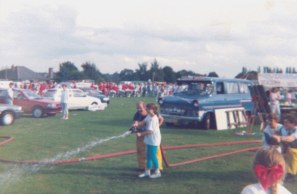
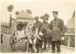
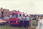
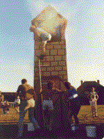
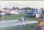
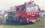
The Fire Brigade were usually in attendance too! |
 |
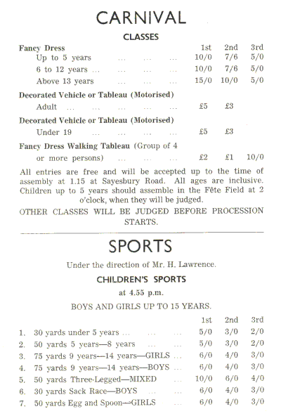
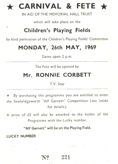
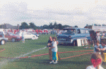
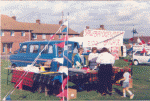
The town carnival
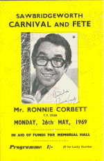
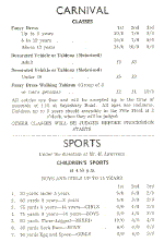
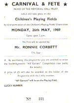
or fete held usually on the Whitsun, later the Spring Bank holiday, became very popular in the late 40's and with quite high attendances, matured through the 50's and into the 60's as will be seen by the Programme for 1969 shown left. Even in the late 50's attendances were around 5,000, quite an attendance figure for a small town with less population than that at that time! |
 |
 |
|
|
| |
|
|
|
 |
 |
 |
 |
|
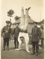
Firemen
Left to
Right:
Harry
Taylor -
Bill
Horsnell
- Frank
Wright |
Firemen
Left to
Right: ?
- Frank
Wright -
Sid
Morgan |
|
|
| |
|
|
|
 |
 |
 |
 |
| |
|
|
|
 |
|
|
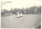
Queen
Elizabeth
II
Jubilee
Celebrations
1977
held in
Sawbridgeworth.
The
station
had
entered
a team
for the
Pram
Race
- Left
to R:
Andy
Ballisat,
Firemen
Paul
Burrell,
Johnny
Williams
plus non
members
to make
up the
team
being:
Neil
Matthews
and
Johnny
Williams'
brother.
The team
came
second
with the
team 27
beside
taking
first
prize.
Photo provided
by Andy
Ballisat
(March 2021) |
|
|
|
|
| |