| |
Miscellanea |
Page last updated:
14/03/2023 |
|
If anyone has more information on any of these
photographs the webmaster would be pleased to update the details. |
 |
 |
 |
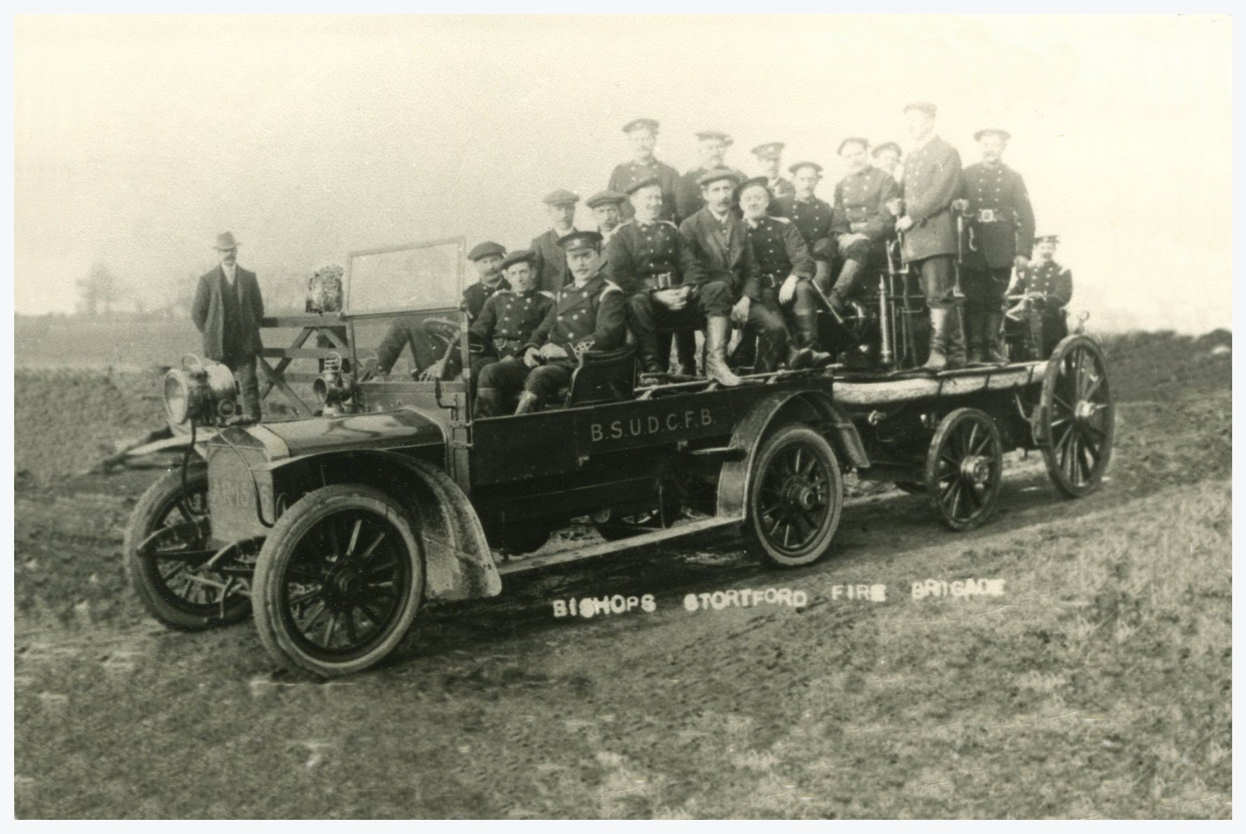
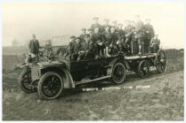
| A photograph of
Bishop's Stortford Fire
Brigade. The date is unknown but is assumed between 1910 to 1920 from
the motor vehicle 'tractor' towing the Steamer together with the firemen's
uniforms. |
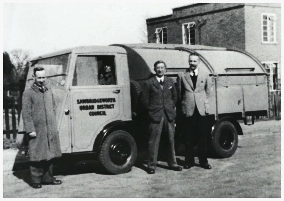
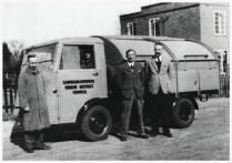
A new dustcart for Sawbridgeworth pictured in the Forebury outside the Council Offices. The
photo is thought to be around the late 1940's and the man with the
moustache is Councillor Wilce Taylor who owned a shop (Pools Stores) in
Bell Street selling Newspapers and Toys. He also owned property in
Sheering Mill Road (Lane). |
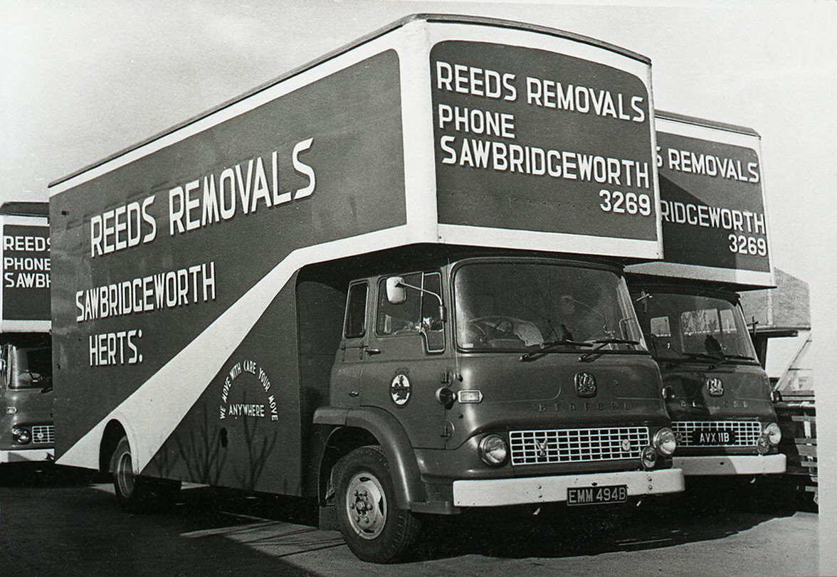
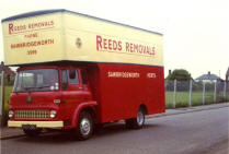
The firm of Reeds were a
familiar site in the area for a good many years. this photo is thought
to be early 1970's and is taken in Cutforth Road. An early base for them
was in the old Assembly Hall that once stood in Station Road close to
the Bull Fields entrance road. |
 |
 |
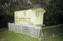 |
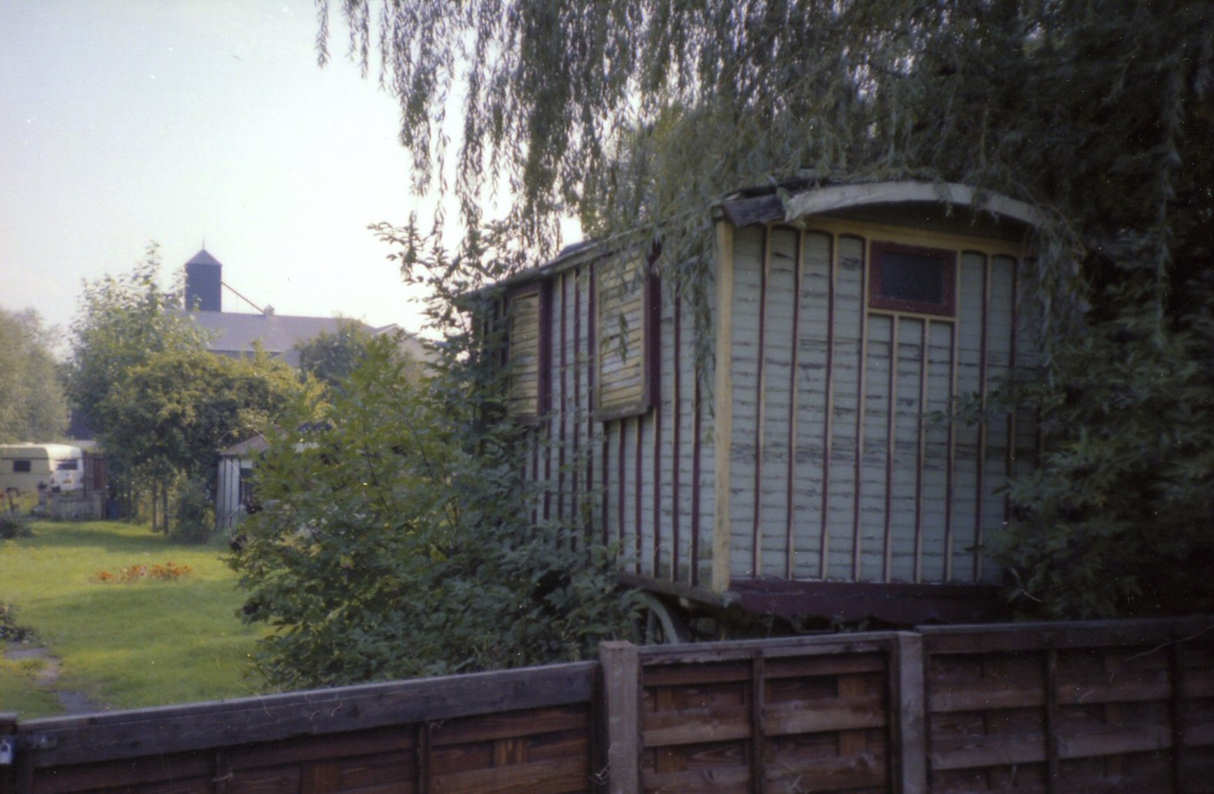
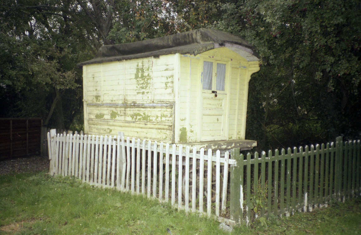
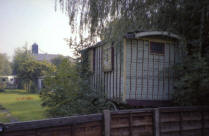
Left: At the rear and river side of
Bridgefoot Farm, Station Road, was a small estate of 'summer time'
residencies known as 'Esbies'. The photos were taken in the mid 1980's.
There were more permanent properties than the caravans shown! The
building in the background is the R5 malting of H. A. & D. Taylor. |
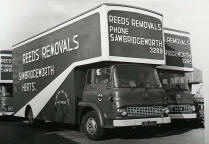
| Some of the fleet of Reed
Removals at their base in Cutforth Road. Photo thought to be middle -
late 1960's |
| All above pictures courtesy
of John Dear |
 |
 |
 |
 |
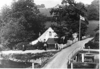
A very early photo of
the Lock House at Sheering Mill which, from the apparent position of the
photographer, was taken from the Mill itself!. In the distance Vantorts Farm and its
stack yard are clearly visible.
Picture courtesy of Richard Dyer.
Some other views of the Lock House & its
history are available
HERE
[With
Acknowledgment to The History of Lee & Stort Navigations Web Site] |
The Railway Hotel in
1910 (before petrol pumps were installed) showing also the Signal Box,
Station Master's House in the background and to the left of it the Goods
Shed. The Railway [Inn] in the 1950's is shown in the 'Town
Views - Events' page.
Picture courtesy of Richard Dyer. |
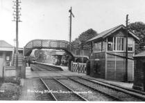
A view of the railway
station probably around 1900. The small building on the 'up' platform
was later replaced by waiting rooms and toilets. The over
bridge was replaced by a concrete structure in the 1950's.
Picture courtesy of Richard Dyer. |
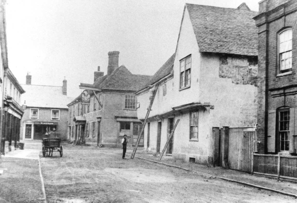
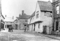
A view of the Market
House - the junction of Knight Street and Bell Street. The house in the
foreground was the house and surgery of Dr. E. N. Hayley (Brigade Chief
Officer 1935-1940) from the early 1930's through until c. the late
1960's.
Picture courtesy of Richard Dyer. |
 |
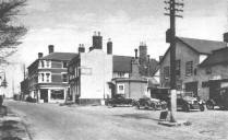 |
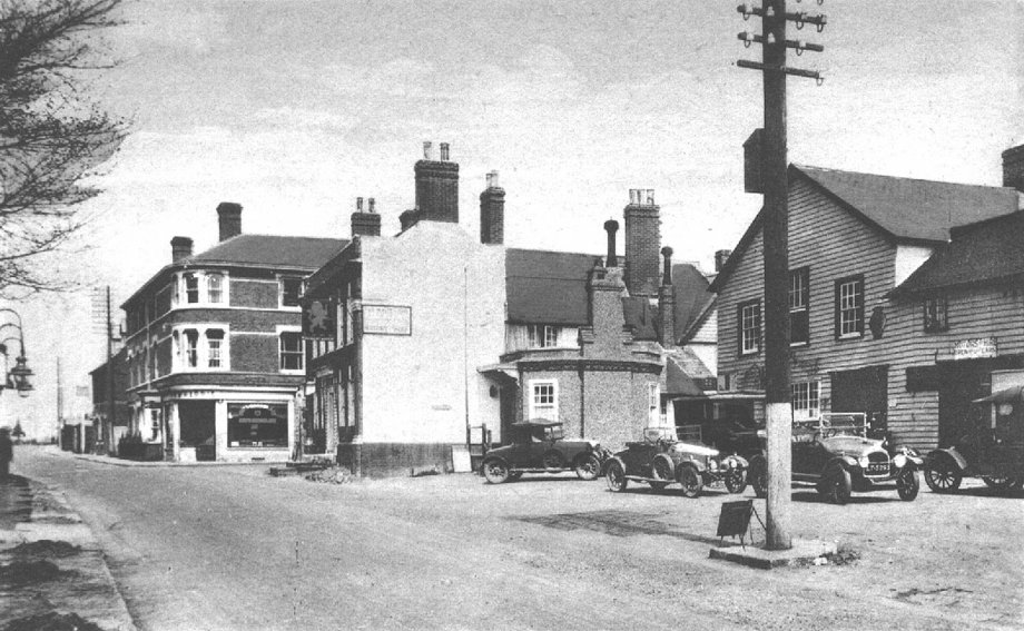
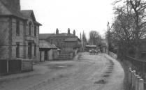
Left: Another
view of the London Road - Bell Street(*) junction, thought to be in 1930
and showing the car park of the Lion Hotel. For many years from around
1935, by the telephone pole, was the main bus stop for the town (#).
Picture courtesy of Richard Dyer. |
 |
|
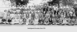
Sawbridgeworth Secondary School 1950 |
|
The school, up until c.1946, was the Church School - the responsibility
of Gt. St. Mary's and stood at the top of the hill rising from Sheering
Mill. The school had allocated horticultural allotments that were on the South
side of the hill adjacent to
Vantorts Farm.
(Photo taken in the playground that backs onto Vantorts Farm itself.) |
|
Photo from the Webmaster's
Library |
|
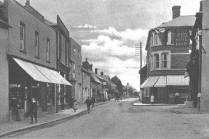
Left: London
Road from the White Lion Hotel forecourt in 1905. The Bell Street
corner on the North side now has the eminent building of Harris's Bakery
that replaces the
earlier building.
Picture courtesy of Richard Dyer. |
(#)
London Country Buses (396)
Double Decker to Epping and Green Line Coaches (720)
to Aldgate. |
(*) In earlier times Bell Street was called Cock Street possibly from
the weather vane (cock) on St. Mary's
Church Steeple. |

|